Come to Tromsø and share Marianne's passion for rural photography: Chasethelighttours.co.uk invites you to experience "Heaven on Earth" with an aurora, fjord, fishing, whale watching, photography or sightseeing tour. | | |
WINDY WITH A CHANCE OF STORMS: Earth is passing through a stream of fast-moving solar wind, setting the stage for a possible outbreak of Northern Lights around the Arctic Circle. NOAA forecasters estimate a 35% chance of geomagnetic storms on Feb. 26th. Aurora alerts: text, voice
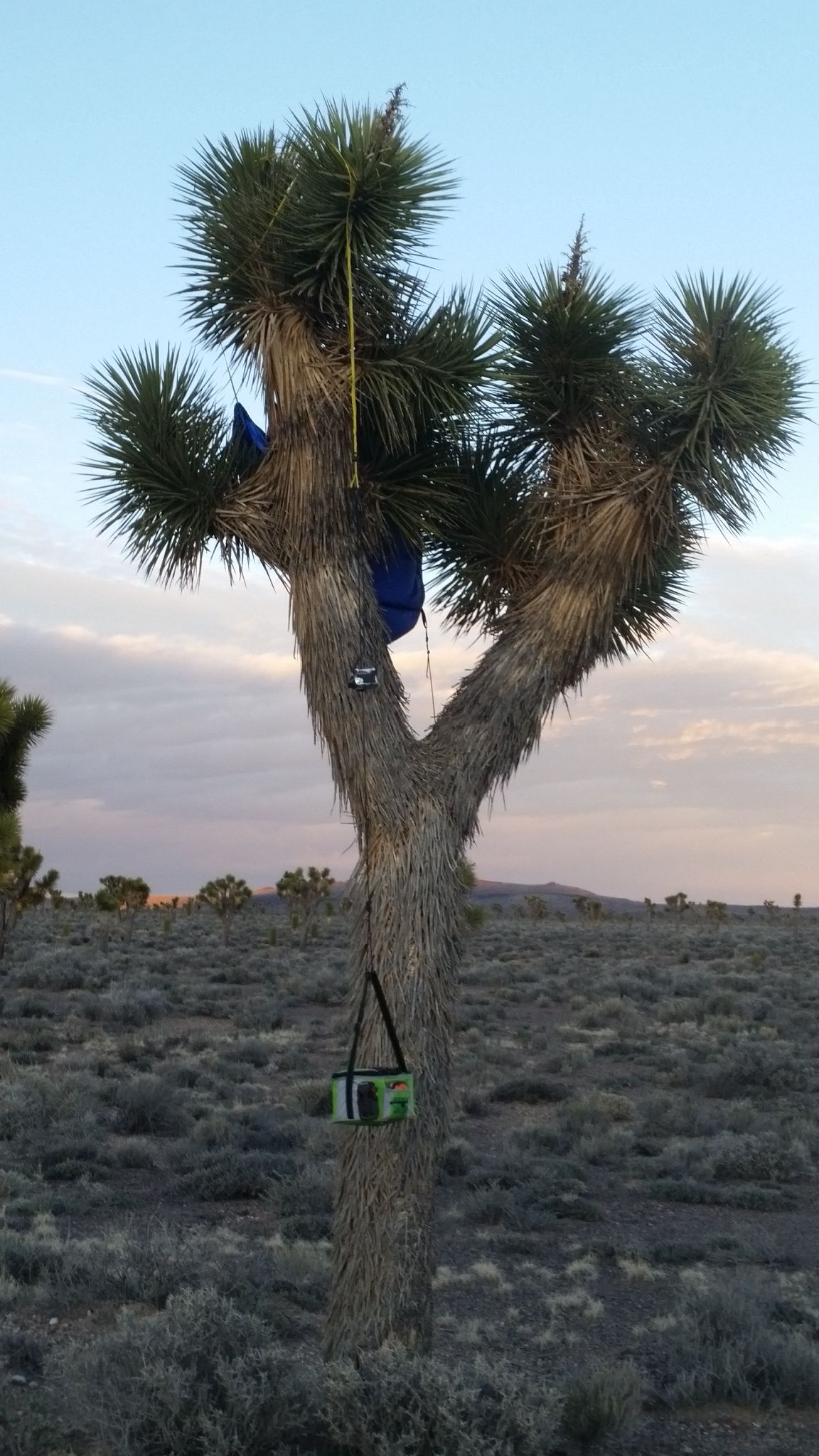
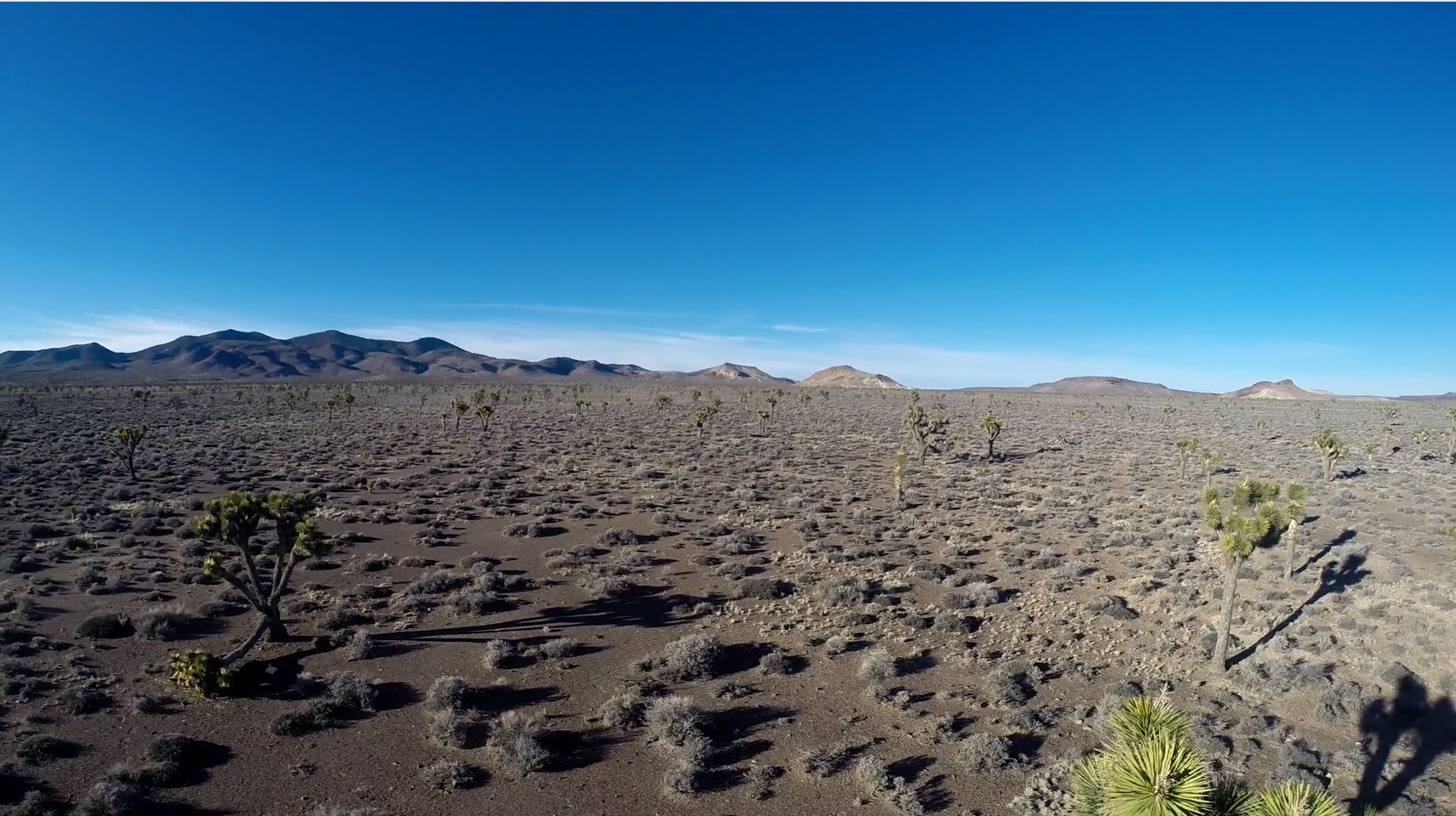
WHAT ARE THE ODDS? On Feb.19th, Spaceweather.com and the students of Earth to Sky Calculus launched a helium balloon to the stratosphere. The payload, a cosmic radiation buoy, traveled 112,300 feet above Earth's surface and drifted more than 85 linear miles from the launch site. When it parachuted back to Earth, it landed in a sparsely vegetated stretch of Nevada desert. Getting caught in a tree would seem unlikely, yet that's exactly what happened:
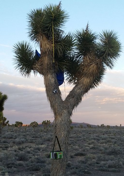
The payload descended into a beautiful forest of Joshua trees, and one of them snagged the parachute. As the student recovery team learned, disentangling the cords of a parachute from the spikey embrace of a Joshua tree is no easy trick. Nevertheless, they persisted and won back their radiation bouy.
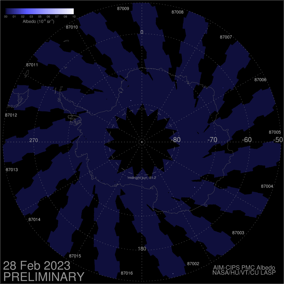
The students have been flying radiation buoys to the stratosphere since 2013. Their purpose is to monitor the effect of cosmic rays and solar activity on the upper atmosphere. This buoy carried a pair of ionizing radiation detectors, sensitive to X-rays, gamma-rays and beta particles in the energy range 10 keV to 20 MeV.
A preliminary look at the Feb. 19th data reveals some of the highest radiation levels recorded in the 2-year history of the program. This could be a result of the current spate of low solar activity. Cosmic rays are repelled by CMEs and strong solar magnetic fields. When the sun is quiet, cosmic rays penetrate the solar system in greater numbers--an effect which the students are monitoring with their balloon flights.
Realtime Space Weather Photo Gallery
WHERE DID THE DEBRIS GO? Sky watchers in western parts of North America were startled on Feb. 24th when a decaying Chinese rocket flew in glowing pieces across the early morning sky. Coincidentally, a geomagnetic storm was underway, so the fragments cut across curtains of Northern Lights on both sides of the Canadian border. It was one of the most scenic re-entries in many years.
Now observers are wondering, where did the debris go? To help answer that question, analyst Rob Matson has plotted weather radar echoes of the fragments. "I put together a composite image of all the Doppler radar returns I could find," he says. "There are actually quite a few distributed into two main clusters, both in western Montana."
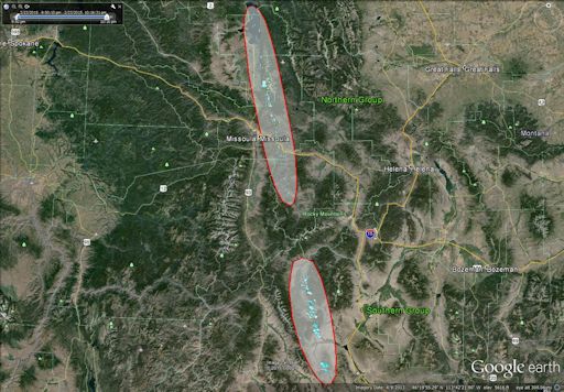
"Most of the returns are from debris at altitudes between 10 km and 18 km," says Matson. "A few are between 4 and 5 km--quite close to the ground. I also found a solitary hit up in Canada--probably something good-sized to continue so far north."
Matson is also examining seismic records. "I've managed to find sonic boom signatures on three seismic stations so far – Missoula, Bozeman and Yellowstone. I suspect I'll find a few more as I dig through the stations closest to the ground track."
No one knows what fraction of the rocket body disintegrated completely in Earth's atmosphere, and what fraction survived the descent to scatter across the landscape of Montana and Canada. Matson's maps may provide some guidance for fragment-hunters. Stay tuned for updates.
Realtime Aurora Photo Gallery
Realtime Comet Photo Gallery
Every night, a network of NASA all-sky cameras scans the skies above the United States for meteoritic fireballs. Automated software maintained by NASA's Meteoroid Environment Office calculates their orbits, velocity, penetration depth in Earth's atmosphere and many other characteristics. Daily results are presented here on Spaceweather.com.
On Feb. 26, 2015, the network reported 4 fireballs.
(4 sporadics)
In this diagram of the inner solar system, all of the fireball orbits intersect at a single point--Earth. The orbits are color-coded by velocity, from slow (red) to fast (blue). [Larger image] [movies]
Potentially Hazardous Asteroids (
PHAs) are space rocks larger than approximately 100m that can come closer to Earth than 0.05 AU. None of the known PHAs is on a collision course with our planet, although astronomers are finding
new ones all the time.
On February 26, 2015 there were 1551 potentially hazardous asteroids.
Notes: LD means "Lunar Distance." 1 LD = 384,401 km, the distance between Earth and the Moon. 1 LD also equals 0.00256 AU. MAG is the visual magnitude of the asteroid on the date of closest approach. | | The official U.S. government space weather bureau |
| | The first place to look for information about sundogs, pillars, rainbows and related phenomena. |
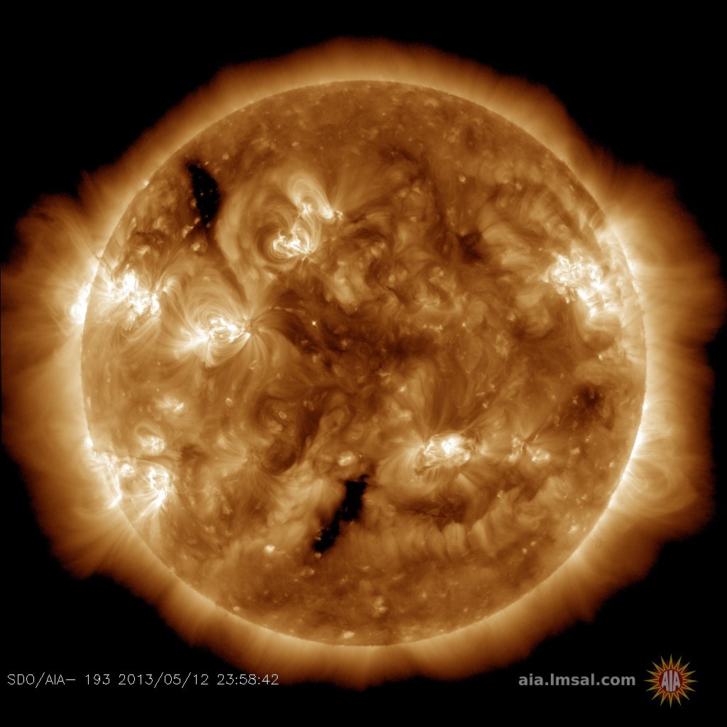
| | Researchers call it a "Hubble for the sun." SDO is the most advanced solar observatory ever. |
| | 3D views of the sun from NASA's Solar and Terrestrial Relations Observatory |
| | Realtime and archival images of the Sun from SOHO. |
| | from the NOAA Space Environment Center |
| | the underlying science of space weather |


