When is the best time to see auroras? Where is the best place to go? And how do you photograph them? These questions and more are answered in a new book, Northern Lights - a Guide, by Pal Brekke & Fredrik Broms. | | |
GEOMAGNETIC ACTIVITY: Earth's magnetic field is unsettled today following the arrival of a CME during the early hours of August 27th. Around the North and South Poles, high-latitude sky watchers are reporting intermittently-bright auroras, like these photographed last night by Mike Theiss on the east coast of Iceland:
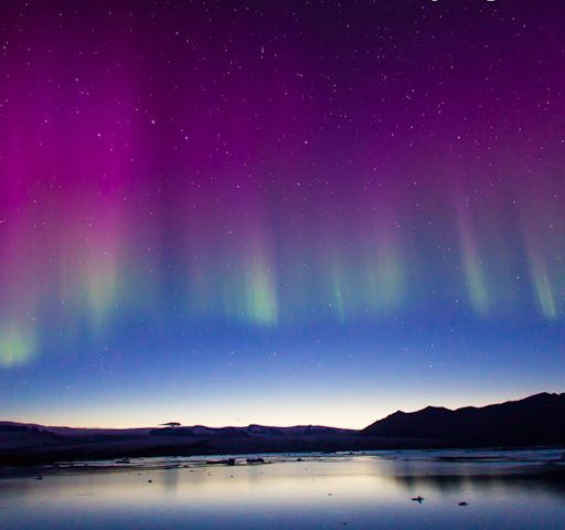
"The lights were incredible," says Theiss. "They changed intensity on and off for about 3 hours." Additional reports have come from New Zealand, Canada and northern-tier US states such as Maine, Michigan, Wisconsin, Idaho, North Dakota, and Washington: photo gallery.
The CME that instigated the display was launched toward Earth on Aug. 22nd. As NOAA analysts predicted, the solar wind speed did not change much when the slow-moving CME arrived. However, the storm cloud was still effective because it contained a south-pointing magnetic field that opened a crack in Earth's magnetosphere. Solar wind is poured in to fuel the show.
High-latitude sky watchers, if it is dark where you live, be alert for auroras. Solar wind conditions continue to favor geomagnetic activity as August 27th unfolds. Aurora alerts: text, voice
Realtime Aurora Photo Gallery
COMET CANDIDATE LANDING SITES SELECTED: Working over the weekend, Rosetta mission planners and scientists narrowed a list of 10 candidate landing sites to only 5. They are circled in this image of the core of 67P/Churyumov-Gerasimenko:
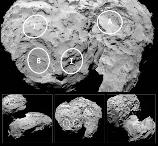
In mid-November, Rosetta's Philae lander will attempt to touch down in one of these locations--the first time humankind has ever landed a probe on the core of a comet.
The candidate sites are distributed as follows: three (I, B and J) on the comet's smaller lobe and two (A and C) on the larger. The comet's canyon-like neck has been excluded. All of the candidate landing sites provide at least six hours of daylight per comet rotation and offer some flat terrain. According to the ESA, every site has the potential for unique scientific discoveries by the lander's 10 instruments.
A full discussion of each site may be found in this ESA press release. By September 14th, the five candidates will have been assessed and ranked, leading to the selection of a primary landing site, for which a fully detailed strategy for the landing operations will be developed, along with a backup. Stay tuned for updates as the selection process unfolds.
Realtime Comet Photo Gallery
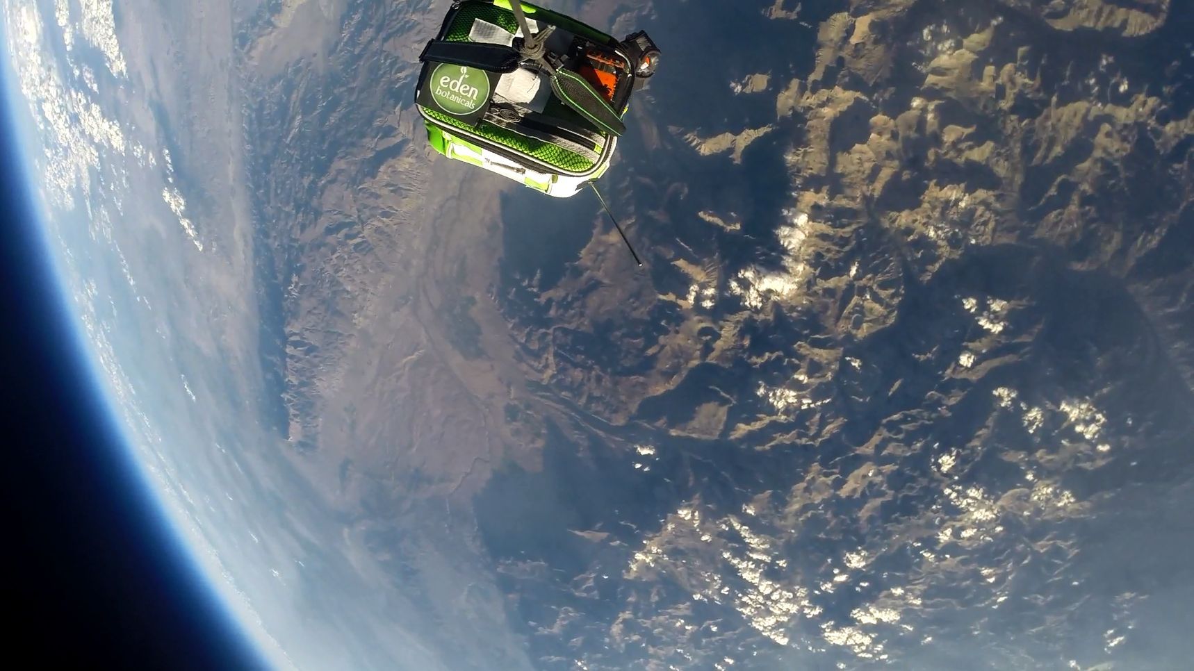
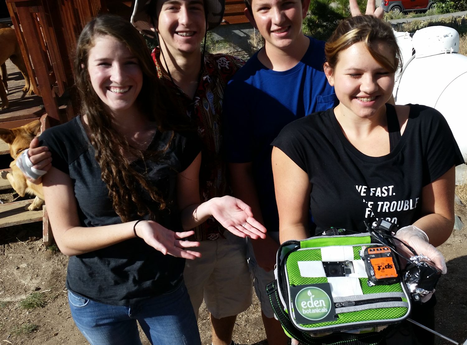
STRATOSPHERIC SPACE WEATHER BUOY: Have you ever wondered what a lunchbox suspended 112,000 feet above Earth's surface would look like? The answer is, this:
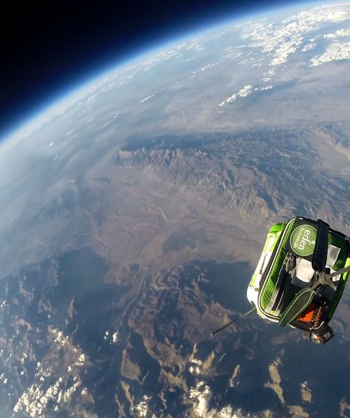
This is actually a Space Weather Buoy--a lunchbox containing a cosmic ray detector, cameras, GPS trackers, a thermometer and other sensors. It flew to the stratosphere on August 22nd tethered to a suborbital helium balloon. In collaboration with Spaceweather.com, the students of Earth to Sky Calculus have been launching these buoys on a regular basis to study the effect of solar activity on Earth's upper atmosphere. Soon, they will release results from a year-long campaign covering altitudes of interest to aviation, space tourism, and ozone research.
The students wish to thank Eden Botanicals for sponsoring the August 22nd flight. (Note their logo on the corner of the payload.) This was the student group's 58th successful launch--almost all paid for by a combination of donations and commercial advertising.
Readers, would you like to sponsor the next flight of the Space Weather Buoy? For only $500 you can send your logo to the edge of space and help students continue their explorations of the stratosphere. Contact Dr. Tony Phillips for more information.
Realtime Space Weather Photo Gallery
Realtime Meteor Photo Gallery
Realtime NLC Photo Gallery
Every night, a network of NASA all-sky cameras scans the skies above the United States for meteoritic fireballs. Automated software maintained by NASA's Meteoroid Environment Office calculates their orbits, velocity, penetration depth in Earth's atmosphere and many other characteristics. Daily results are presented here on Spaceweather.com.
On Aug. 27, 2014, the network reported 37 fireballs.
(36 sporadics, 1 Northern delta Aquariid)
In this diagram of the inner solar system, all of the fireball orbits intersect at a single point--Earth. The orbits are color-coded by velocity, from slow (red) to fast (blue). [Larger image] [movies]
Potentially Hazardous Asteroids (
PHAs) are space rocks larger than approximately 100m that can come closer to Earth than 0.05 AU. None of the known PHAs is on a collision course with our planet, although astronomers are finding
new ones all the time.
On August 27, 2014 there were 1495 potentially hazardous asteroids.
Notes: LD means "Lunar Distance." 1 LD = 384,401 km, the distance between Earth and the Moon. 1 LD also equals 0.00256 AU. MAG is the visual magnitude of the asteroid on the date of closest approach. | | The official U.S. government space weather bureau |
| | The first place to look for information about sundogs, pillars, rainbows and related phenomena. |
| | Researchers call it a "Hubble for the sun." SDO is the most advanced solar observatory ever. |
| | 3D views of the sun from NASA's Solar and Terrestrial Relations Observatory |
| | Realtime and archival images of the Sun from SOHO. |
| | from the NOAA Space Environment Center |
| | the underlying science of space weather |


